
Forest Security: Early Fire Detection, Thermal Cameras, and Artificial Intelligence Systems
Forest security requires the combined use of cameras, thermal imaging, artificial intelligence, camera traps, drones, and satellite technologies to detect fires early, prevent unauthorized activities, and protect natural areas. We examine OGM’s ORİKEM initiative, smart surveillance towers, AI smoke detection, remote communications and solar-powered systems, technical selection criteria, and legal requirements in Türkiye.
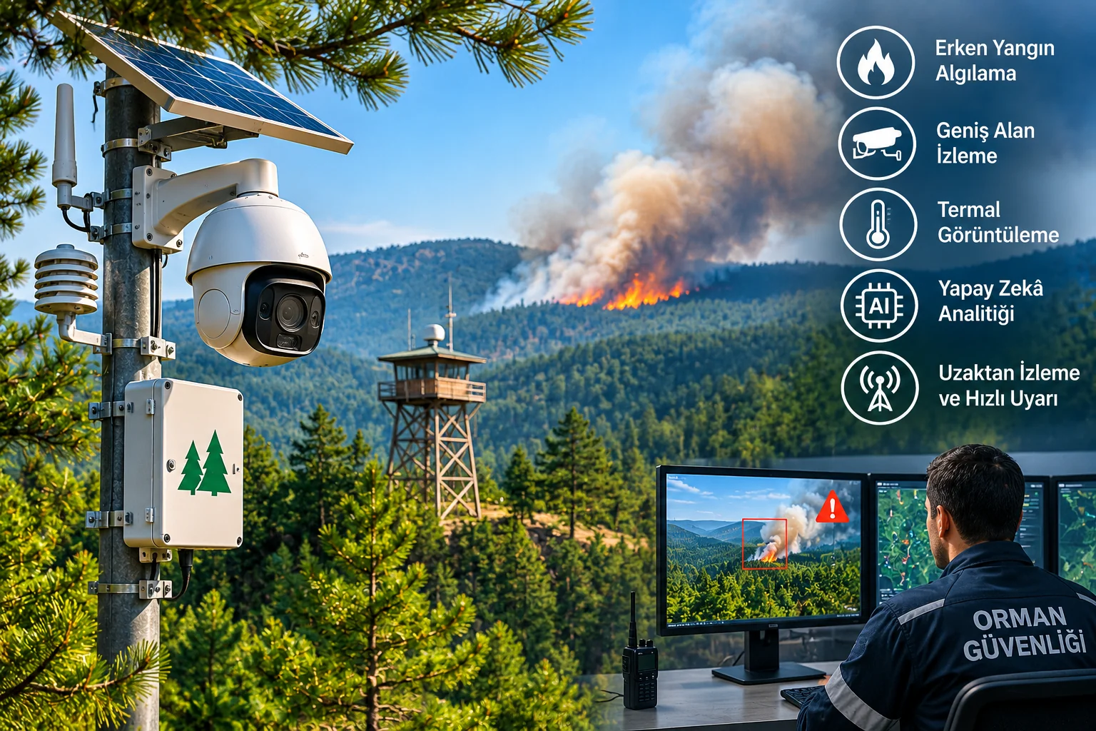
Forest security comprises the physical, technological, and operational measures used to protect forested areas from fires, illegal logging, unauthorized activities, environmental pollution, and other human-caused or natural threats. The vast geographical spread of forests, complex terrain, and lack of electricity and communications infrastructure in many locations make security operations different from conventional security for buildings and facilities.
Today, forest security may involve optical and thermal cameras, AI-powered image analysis, smart surveillance towers, camera traps, unmanned aerial vehicles, satellite imaging systems, and centralized monitoring software.
These technologies can help detect specific risks early and enable authorized teams to assess incidents more quickly. However, no single camera, drone system, or AI algorithm can protect every forested area continuously and without error.
Effective forest security is a multilayered approach that jointly manages prevention, early detection, incident verification, reliable communications, rapid notification of authorized agencies, and field response.
What Is Forest Security?
Forest security encompasses efforts to prevent and monitor incidents that threaten forest ecosystems and human activities associated with forests, and to have them assessed by authorized institutions when necessary.
Key security objectives include:
Preventing forest fires and detecting them early.
Detecting illegal logging and the transport of forest products.
Monitoring unauthorized activities in designated areas.
Controlling forest roads and entry points.
Contributing to the protection of wildlife and sensitive ecosystems.
Supporting the detection of activities such as environmental pollution and unauthorized dumping.
Ensuring the continuity of fire surveillance and communications infrastructure.
Helping ensure incidents are reported to authorized agencies with accurate location and information.
Forest security does not mean CCTV installation alone. Surveillance technologies must be planned in conjunction with forestry operations and the work of relevant institutions.
Why Is Forest Security Important in Türkiye?
In Türkiye, forests are affected not only by natural disasters but also by human activities.
The General Directorate of Forestry’s 5 November 2026 assessment stated that 2,111 forest fires had been reported for 2026.
According to the same assessment, the fires were classified as follows:
67% due to negligence and carelessness,
16% accidental,
3% deliberate acts,
14% lightning
as the cause.
These figures show that human behavior, awareness, forest-entry controls, and oversight of high-risk activities are important to fire prevention.
Meanwhile, conditions such as high temperatures, low humidity, and strong winds can accelerate the spread of fires.
For this reason, a forest security strategy must go beyond obtaining images after a fire has started.
Key Risks to Forest Security
Risk | Possible outcome | Technology that can provide support |
|---|---|---|
Forest fire | Loss of life, ecological and economic damage | Optical/thermal monitoring, AI smoke analysis |
Unauthorized logging | Damage to forest resources | Camera traps, field inspections |
Illegal transport of forest products | Illegal activities | Vehicle monitoring and authorized checkpoints |
Unauthorized entry | Access to sensitive areas | Entry camera, suitable incident detection |
Illegal dumping | Soil and environmental pollution | Camera traps, event-based recording |
Communications outage | Delayed alarms and reports | Backup communications and fault monitoring |
Power outage | Surveillance system going offline | Solar power, battery |
Harsh weather conditions | Reduced detection performance | Multiple sensors and maintenance plan |
Not every forested area needs the same security technologies for every risk.
System selection should be based on terrain, risk level, the needs of authorized institutions, and existing infrastructure.
How Are Forest Fires Detected Early?
The primary aim of early forest-fire detection is to notice the first signs of a fire as soon as possible and deliver accurate location information to authorized agencies.
Methods include staffed lookout towers, optical cameras, thermal sensors, drone systems, and satellite-derived information.
Smoke Detection with Optical Cameras
Optical security cameras form images using visible light.
Suitable image-analysis software can assess certain visual characteristics of smoke rising over a forested area.
AI algorithms can use features such as the smoke’s appearance, movement, and changes in the scene.
However, optical smoke detection can be affected by:
Fog and low clouds.
Atmospheric haze.
The angle of sunlight.
Reduced image detail at long distances.
Obstructions from trees or terrain.
Camera image compression.
Changes in smoke appearance caused by wind.
An AI-powered camera’s ability to detect smoke does not mean it can detect every fire at the moment it starts.
Hot-Spot Detection with Thermal Cameras
Thermal cameras detect infrared energy emitted by objects and create images based on temperature differences.
Suitable devices can help identify specific hot surfaces or unusual thermal areas.
In forested areas, thermal cameras can be used in particular for:
Monitoring specific hot spots.
Night imaging.
Inspecting suitable areas after a fire.
Assessing temperature anomalies
purposes.
However, thermal sensors do not have unlimited detection capability either.
Dense vegetation, obstructions in the line of sight, atmospheric conditions, and the portion of the image occupied by the target affect performance.
For example, the hot area of a fire developing beneath tree cover may not be within the camera’s direct field of view.
Bispectral Cameras
Bispectral cameras combine thermal and optical imaging technologies.
In suitable systems, an event may be assessed through an optical image after a thermal anomaly is detected.
It should not be assumed that thermal and optical sensors provide the same image detail, field of view, or detection range.
The actual performance of both sensors should be verified through field testing.
How Is Artificial Intelligence Used in Forest Fires?
AI-powered forest surveillance systems can analyze camera images or other suitable sensor data and generate alerts about specific events.
The general process is as follows:
The camera or sensor collects data.
The image is sent to suitable processing infrastructure.
The algorithm assesses smoke, temperature anomalies, or other defined indicators.
The system generates an alert under specified conditions.
The operator checks the image and location information.
The verified incident is passed into the authorized response chain.
Edge AI and Centralized Analysis
In some systems, image analysis is performed on the camera itself. This approach is called Edge AI ; in others, video data is sent to a central server or analysis platform.
In other systems, video data is sent to a central server or analysis platform.
The two approaches can offer different advantages.
Feature | On-camera analysis | Centralized analysis |
|---|---|---|
Processing location | Camera | Server or control center |
Network requirements | May be lower for certain events | May be higher, depending on the application |
Processing capacity | Limited by camera hardware | Depends on the server architecture |
Management | Device-based | Centralized |
Maintenance | Distributed device management | Central infrastructure management |
Limitation | Processing resources of the edge device | Dependence on the network and server |
Because internet and power infrastructure is limited in forested areas, the analysis architecture must be designed alongside communications conditions.
False Alarms in Forest-Fire Camera Systems
One of the most important quality criteria for AI fire-detection systems is balancing the detection of genuine fire indicators against false alarms.
For example, some algorithms may mistake fog, clouds, dust, or certain changes in lighting for smoke.
In thermal systems, surfaces heated by the sun and other heat sources can also lead to incorrect assessments.
How Is System Accuracy Measured?
Field validation should not rely solely on the accuracy percentage stated by the manufacturer.
The following performance indicators can be assessed:
KPI | Description |
|---|---|
Detection rate | The proportion of actual incidents detected |
False-alarm rate | The number of unnecessary alarms per unit of time or area |
Detection delay | Time from the first sign of an incident to the first alert |
Verification time | Time taken by the operator to assess the alert |
Location accuracy | How close the reported incident location is to the actual location |
System availability | Time during which the monitoring system is operational |
Notification success | Rate at which alarms reach the correct recipient |
Particularly in forest-fire detection projects, detection time and false-alarm rate should be assessed together.
An excessively high number of false alarms can undermine operators’ ability to assess genuine incidents.
Forest Lookout Towers and Smart Camera Systems
Fire lookout towers are important infrastructure used to detect forest fires early.
In traditional operations, personnel keep watch; modern systems can use towers supported by suitable camera and communications technologies.
The General Directorate of Forestry’s 2026 preparedness announcements refer to smart lookout towers and communications infrastructure within forests.
What Systems Might a Smart Lookout Tower Include?
Long-range optical camera.
PTZ or panoramic imaging.
Suitable thermal camera.
AI-powered incident analysis.
Positioning and mapping software.
Radio or IP communications.
Solar power and energy storage.
Lightning protection and surge protection measures.
Remote fault monitoring.
How Is a Tower Location Determined?
Tower placement should not be based solely on finding a high hill.
In particular, the following should be considered:
Terrain elevation model.
Line of sight.
Valleys and blind spots.
Height of forest cover.
Overlap with existing lookout towers.
Communications link.
Access to power and maintenance.
Environmental impacts and permits
should be assessed.
Viewshed analysis using geographic information systems can help identify potential blind spots.
However, an area that appears theoretically visible on a map may not be monitored in the same way in the field because of fog, tree growth, and seasonal conditions.
What Is ORİKEM? Artificial Intelligence in Forest Security
One of the forest-protection initiatives in Türkiye is the General Directorate of Forestry’s ORİKEM (Integrated Forest Monitoring, Protection and Response) project.
According to OGM’s announcement dated 29 September 2025, camera traps and AI-powered analysis systems are used under ORİKEM to detect illegal activities in forests.
The project’s main objectives include:
Detecting forest crimes.
Transmitting incidents to the relevant agencies.
Analyzing camera-trap images.
Classifying incidents.
Compiling statistics on protection activities.
Supporting field inspection and response processes
are among them.
In its 2025 announcement, OGM said that camera traps were in use in 30 Regional Directorates of Forestry.
These systems can provide event-based imaging, particularly in certain areas where it is difficult to keep personnel on site continuously.
However, it should not be assumed that camera traps continuously image the entire forest area or can detect every illegal activity.
Camera-Trap Systems in Forest Security
Camera traps are cameras, generally designed for low power consumption, that capture images in response to specific movement or events.
In forested areas, they can be considered for:
Designated entry points.
Suitable crossings on forest roads.
Areas at risk of unauthorized dumping.
Specific hotspots for risks related to illegal activities.
Authorized scientific wildlife-monitoring studies
purposes.
The Difference Between a Camera Trap and an IP Camera
Feature | Camera trap | Fixed IP camera |
|---|---|---|
Primary use | Event-based imaging | Continuous or event-based video |
Power | Usually battery-powered | PoE, adapter, or dedicated power solution |
Communications | Local storage card or cellular connectivity on some models | Ethernet, Wi-Fi, cellular |
Continuous recording | Limited on most models | Possible on suitable models |
Installation | Relatively flexible | More extensive infrastructure may be needed |
Key limitation | Event triggering and power | Network, power, and coverage |
Camera traps can be used not only for forest security but also in ecological research.
Therefore, the monitoring objective, data storage, and potential effects on wildlife should be determined in advance.
Using Drones in Forest Security
Drone systems can help assess areas outside fixed cameras’ fields of view from the air as part of specific missions.
In an announcement dated 17 June 2025, the General Directorate of Forestry said it used drone technologies equipped with thermal cameras and public-address systems for pre-fire risk assessment and field monitoring.
Another announcement dated 18 June 2026 described field work involving the use of multipurpose drones during firefighting operations in Adana.
What Tasks Can Drones Perform?
Assessing specific fire indicators from the air.
Observing suitable areas after a fire.
Inspecting the condition of forest roads.
Checking water sources and specific infrastructure points.
Transmitting incident images to authorized field teams.
Imaging hard-to-reach areas as part of specific missions.
Drone systems are not a direct substitute for continuous surveillance towers.
Flight time, weather, power, operational permits, and communications are all limiting factors.
Legal Conditions for Drone Use in Türkiye
The Directorate General of Civil Aviation, 30 July 2026 the updated Instruction on Unmanned Aircraft Systems (SHT-İHA), bringing it into force.
The regulation covers UAV registration, licensing, pilot authorization, operations, and flight permits.
The new instruction defines pilot licence levels P0, P1, and P2, and sets a transition period through 31 July 2027 for existing certificate holders.
Applicable airspace restrictions, pilot authorization, and operating conditions must also be verified for drone systems used in forest surveillance.
Important: Unauthorized drones must not be flown near active forest fires. Such flights could endanger the work of authorized aviation and firefighting teams.
Monitoring Forest Fires with Satellite Technologies
Satellite data play an important role in assessing fire risks across wide geographic areas and identifying specific temperature anomalies.
Two international systems are:
NASA FIRMS.
Copernicus EFFIS.
platforms.
What Is NASA FIRMS?
NASA’s Fire Information for Resource Management System (FIRMS) platform provides active-fire and thermal-anomaly data from satellite sensors.
These data can help assess large areas and monitor specific incidents.
However, NASA explicitly states that satellite-derived hot-spot data have location and detection limitations.
For example, the VIIRS active-fire products have a detection pixel of approximately 375 metres.
This does not mean the entire 375-metre area is burning.
What Is Copernicus EFFIS?
European Forest Fire Information System (EFFIS)provides information on forest-fire danger, active fires, and post-fire impacts in Europe and surrounding regions.
The system also provides meteorological fire-danger maps and forecasts.
However, a fire-danger forecast are not a record indicating that a fire is already present in that area.
Can Satellite Data Replace Camera Systems?
No.
Satellite data provide a broad-area view, while fixed cameras can monitor specific areas more frequently.
Satellite data have limitations such as:
Revisit and update frequency.
Pixel resolution.
Cloud and smoke cover.
Failure to detect small fires.
The possibility that hot spots are caused by sources other than fires
and other factors.
NASA FIRMS explicitly states that these data should not be used alone to make decisions concerning the safety of life or property.
The most suitable approach is therefore to assess satellite data together with local surveillance, information from authorized agencies, and field verification.
How Is Viewing Distance Calculated for Forest Security Cameras?
One of the most common mistakes when selecting cameras for forested areas is to assume that the manufacturer’s stated long-range figure applies to every detection task.
A camera’s ability to image terrain at a particular distance does not mean it can reliably detect a small smoke plume or a person at that distance.
Optical Imaging
Optical-camera performance depends on:
Sensor resolution.
Lens focal length.
Horizontal and vertical field of view.
Target size.
Terrain and atmospheric conditions.
Video compression.
The target types supported by the algorithm
and other parameters.
Thermal Imaging
Sensor resolution, the lens, and the target’s thermal characteristics are also important for a thermal camera.
For example, a hypothetical thermal camera with 640 horizontal pixels and a 14-degree horizontal field of view images an area approximately 246 metres wide at a distance of 1,000 metres.
In this case, the theoretical pixel density is approximately:
640 ÷ 246 = 2.6 pixels/metre
This is the result.
This calculation shows image geometry only.
It does not prove that a fire, person, or vehicle can be detected reliably at this distance.
Thermal contrast, atmospheric transmission, target size, line of sight, and algorithm performance must be assessed separately.
In forest surveillance projects, the detection distances stated by the camera manufacturer for specific targets should be verified through actual field tests.
Communications Infrastructure for Forest Security Systems
One of the main challenges in forested areas is limited communications infrastructure.
Mountainous terrain, valleys, and dense vegetation can affect connection quality.
Technologies that may be used include:
Suitable 4G/5G cellular connections.
Point-to-point wireless radio bridges.
Professional radio communications systems.
Suitable fibre-optic connections.
Other radio links, subject to the necessary licences and permits.
Satellite communications at certain remote sites.
may be available.
Is 4G Connectivity Enough for Forest Cameras?
It may be sufficient for some applications if suitable coverage is available at the site.
However, seeing a signal on a phone screen alone is not a sufficient test for professional video transmission.
A proper assessment should measure uplink capacity, connection stability, latency, data consumption, and behaviour during outages.
Example Camera Bandwidth Calculation
Suppose each of four IP cameras produces an average video stream of 3 Mbps.
4 × 3 Mbps = 12 Mbps
The system’s total average video data rate would be approximately 12 Mbps.
However, additional capacity is needed for protocol overhead, simultaneous users, the recording architecture, and variable bit rates.
Whether all cameras send continuous video to the central system should also be determined according to the project architecture.
At certain remote sites, sending images only when an event occurs or using local analysis can help reduce network load.
Solar-Powered Forest Security Cameras
Solar-powered camera systems can be considered at locations in forested areas without grid electricity.
Such solutions generally include:
Solar panel.
Charge controller.
Suitable battery.
IP or thermal camera.
Communications equipment.
Protection and power-distribution components
are included.
How Are Solar Panels and Batteries Sized?
Suppose the total average power consumption of a camera and communications system is 30 W.
Daily energy requirement:
30 W × 24 hours = 720 Wh/day
To operate for two days without solar generation, the load alone would require:
720 Wh × 2 = 1,440 Wh
of usable energy.
However, this figure is not the nominal capacity of the battery to be selected.
Battery selection should also account for:
Usable discharge capacity.
Battery efficiency.
Temperature effects.
Ageing.
Control and conversion losses.
Seasonal solar conditions
must also be assessed.
Likewise, solar-panel capacity should not be determined solely by the camera’s wattage.
Conditions such as forest shade, winter months, and panel soiling can significantly reduce actual energy generation.
Centralized Monitoring for Forest Security Systems
Centralized monitoring software can become important in projects with multiple cameras, lookout towers, camera traps, or sensors.
Suitable systems can manage the following together:
Camera status information.
Live images.
Alarm events.
Geographic location.
Incident date and time.
Communications faults.
Operator assessments.
Notifications sent to field teams
can be managed together.
GIS Integration in Forest Security
Geographic information systems (GIS) are particularly valuable in forest security.
Rather than reporting a camera alarm only as “Camera 7,” assessing it using a verified location, tower information, and a map layer can support response operations.
However, it should not be assumed that a camera automatically determines an incident’s geographic coordinates accurately when it generates an alarm.
Location accuracy depends on camera and map calibration, the terrain model, and the positioning method used.
Example Forest Security System Architecture
A multilayered system such as the following could be considered for a large forest area.
System layer | Components | Primary function |
|---|---|---|
Wide-area surveillance | Optical/PTZ and suitable thermal cameras | Monitoring smoke and specific incidents |
At-risk entry points | Fixed IP camera and camera trap | Imaging specified activities |
Mobile observation | Authorized drone teams | Assessing incidents in specific areas |
Regional data | Satellite and meteorological data | Fire risk and situational awareness |
Communications | Suitable radio, fibre, or cellular network | Transmitting incident data |
Central management | VMS, GIS, and alarm management | Incident verification and recording |
Response coordination | Authorized forestry and emergency services | Field assessment and response |
This table is an example architecture, not a mandatory product list.
The scale and actual requirements of a forest security application should be determined in line with the operational plans of authorized institutions.
Legal Requirements for Forest Security in Türkiye
Among the principal legal regulations governing forest protection is the Forest Law No. 6831 included.
Provisions on preventing forest fires, forest products, requiring permits for certain activities, and forest offences are addressed under this legislation.
Restrictions on Entering Forests
In Türkiye, restrictions on entering forests may be set by province or region according to fire risk and relevant conditions.
For example, in 2026, restriction orders with different start and end dates were issued for different provinces.
It would therefore be inaccurate to claim that the same entry ban applies throughout the year in every forest in Türkiye.
Current restrictions should be checked in the latest announcements from the relevant governor’s offices and authorized forestry agencies.
Camera Installation and Permits
Installing a camera pole, lookout tower, power system, or communications infrastructure in a forested area may require relevant administrative permits, depending on the legal status of the land and the scope of the activity.
The fact that a forest is open to the public does not mean that anyone may freely install surveillance devices or communications towers there.
KVKK and the Protection of Personal Data
If images that can identify individuals are captured at forest entrances, recreation areas, or other locations, personal data protection legislation should be assessed.
In this context:
The monitoring purpose should be defined.
The authorized data controller and legal basis should be assessed.
Unnecessary imaging should be restricted.
The retention period for recordings should be defined.
Unauthorized access should be prevented.
Images should not be shared for purposes other than those intended.
Intrusive features such as facial recognition and audio recording should be assessed separately.
In nature-conservation projects, unnecessary disclosure of location information sensitive to wildlife should also be prevented.
What Should You Do If You See a Forest Fire?
In forest security, accurate reporting and response procedures are as important as technology.
The General Directorate of Forestry, in its announcement dated 30 July 2026, that any smoke or fire observed be reported without delay to the 112 Emergency Call Centre .word ;
People who see signs of a fire should:
Move to a safe location.
Avoid endangering themselves by trying to control the fire on their own.
Give 112 the most accurate possible location and observation details.
Follow the instructions of authorized teams.
Keep access routes for response teams at the fire scene clear.
Do not fly unauthorized drones.
Passing an alert from an AI camera or satellite platform to authorized personnel for assessment does not mean the system has initiated firefighting on its own.
What Should You Consider When Choosing Forest Security Systems?
Accurate Risk Definition
Is the project’s main priority early fire detection, monitoring illegal activities, or protecting specific critical locations?
Terrain and Line-of-Sight Analysis
Mountains, valleys, tree cover, and distances should be examined before locating cameras or communications equipment.
Selecting Sensor Technology
Optical, thermal, camera-trap, drone, and satellite solutions do not serve the same function.
Actual Detection Performance
Field verification should supplement the manufacturer’s claims.
False-Alarm Management
False alarms that may be caused by fog, clouds, weather, and other environmental effects should be assessed.
Communications Reliability
Along with connection speed, outage duration and delivery of alarm messages are important.
Power Continuity
Solar, battery, and power-distribution systems should be sized for seasonal conditions.
Central Software Compatibility
Integration of cameras, sensors, alarms, and mapping software should be tested in advance.
Maintenance and Remote Fault Monitoring
Faults in devices at remote sites should be identified as early as possible.
Authorizations and Regulations
Requirements for site installation, drone flights, radio communications, and personal data processing should be verified separately.
Technical Checklist for Forest Security Systems
- Have the forest area to be protected and its risks been defined?
- Have fire and illegal-activity scenarios been distinguished?
- Has a terrain elevation model and line-of-sight analysis been prepared?
- Have the coverage areas of lookout towers been assessed?
- Have optical and thermal camera requirements been defined?
- Have camera resolution, lens, and target distance been calculated?
- Have the technical limitations of smoke and hot-spot detection been assessed?
- Have false-alarm sources and acceptance criteria been defined?
- Has the event-triggering performance of camera traps been tested?
- Have the need for drones and operational permits been assessed?
- Have communications coverage and data capacity been measured?
- Have solar-panel and battery capacities been calculated?
- Have lightning and surge protection been assessed?
- Have the GIS and incident-location system been tested?
- Has camera/VMS/analytics integration been verified?
- Have communications and power-outage scenarios been tested?
- Has it been confirmed that alerts reach the relevant operator?
- Has a notification procedure for authorized agencies been established?
- Have data security and KVKK requirements been assessed?
- Have maintenance, calibration, and periodic field testing been planned?
Frequently Asked Questions About Forest Security
What is forest security?
Forest security comprises the physical, technological, and operational measures used to protect forest areas from threats such as fires and illegal activities.
Can forest fires be detected with cameras?
Suitable optical and thermal camera systems can help detect certain signs of fire. However, it cannot be guaranteed that they will detect every fire under all conditions.
Can a thermal camera detect a forest fire early?
Thermal cameras can detect certain temperature anomalies under suitable viewing conditions. Performance depends on the target’s size and thermal characteristics, as well as environmental conditions.
Can artificial intelligence detect smoke?
Some video-analytics systems can assess signs of smoke. However, factors such as fog, clouds, lighting, and long distances can cause false alarms or missed incidents.
What is ORİKEM?
ORİKEM is the General Directorate of Forestry’s Integrated Forest Monitoring, Protection and Response project, which uses camera traps, artificial intelligence, and digital data analysis to combat forest crimes.
Are camera traps used in forest security?
Yes. They can be used for event-based imaging at specific entrances, high-risk locations, and in authorized field-monitoring operations.
Can drones detect forest fires?
With suitable cameras and operating conditions, drone systems can help assess certain areas from the air. However, flight time, permits, and weather are important constraints.
Do satellite images show every forest fire?
No. Some fires may go undetected because of satellite-sensor resolution, revisit frequency, atmospheric conditions, and the characteristics of the fire.
Do forest security cameras run on solar power?
They can, with a properly designed solar-panel and battery system. Actual consumption and seasonal solar generation must be calculated to ensure a continuous power supply.
Is internet access necessary for forest security cameras?
It depends on the system architecture. Local analysis and recording can operate without internet access, but remote notifications require suitable communications infrastructure.
Can security cameras be installed in forests?
The necessary permits should be assessed in light of the legal status of the land concerned and the scope of the project. It should not be assumed that installations can be made without authorization in public forest areas.
Where should a forest fire be reported?
For a forest fire or suspicious smoke seen in Türkiye, the 112 Emergency Call Centre .word
Conclusion: Technology and Early Response in Forest Security
Forest security is a broad field that requires technology and human resources to be managed together to protect natural areas.
AI-powered cameras, thermal imaging, lookout towers, camera traps, drone systems, and satellite data can help assess certain risks earlier.
In Türkiye, the General Directorate of Forestry’s ORİKEM project and smart-surveillance initiatives show how digital technologies can be incorporated into forest-protection work.
However, no technology on its own can guarantee the complete prevention of fires, detection of all illegal activities, or uninterrupted communications.
Effective forest security should be built on accurate risk analysis, reliable detection, a low false-alarm rate, accurate location data, uninterrupted communications, and timely assessment by authorized field teams.
Forest security projects should therefore prioritize not only camera or sensor specifications, but also the system’s overall operability in real field conditions and its long-term sustainability.